


call for details
Background
Utilities traverse the underground environment in unexpected directions and at variable depths. While objects within concrete have a somewhat predictable rise and run, the path of utilities within the earth can change radically. Often the only known information is the beginning and end points of a utility run.
Utilities will often take the most direct path between two points. The only problem is that all of the different contractors on a job compete with one another to find the path of least resistance. The result is that at intersection points different utility runs must change in both direction and elevation.
In addition to locating utilities customers often require general knowledge of the underground environment at their sites. At the San Grigorio Water Aquifier Digital Concrete was asked to look at both the structure of the concrete, and the environment under the slab.
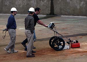
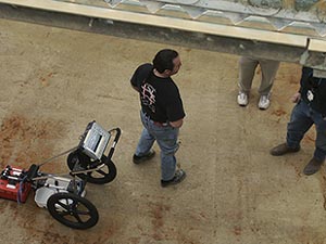
Above and below a 400 Mhz antenna can scan to a depth of 10 feet. Utilizing the portable GSSI SIR-2000 Ground Penetrating Radar system, we we able to see not only the structure of the concrete, but also the presence of voids under the slab.

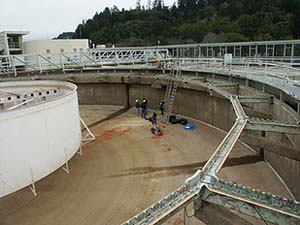
Above, at the Lawrence Berkeley Laboratory, Digital Concrete was called in to locate two utility pipes. Their location under the slab was unknown as the as-built drawings were no longer accurate due to building upgrades. In addition to high-voltage conduit we also had to locate all reinforcement in the slab. Our layout and techniques allowed us to find both of the utility pipes, and prevent the coring team from interacting with the deadly high-voltage conduit.
|
At the Carleton Elementary School a 3'x12' area was scanned to find water pipes and other underground structures. Backfill preventers had to be installed in the school's water lines.
The only problem was that the school had been constructed 30 years ago and no as-built drawings existed. School-district personnel had no knowledge about any of the underground structures at this particular elementary school.
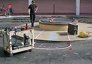
Before upgrading central-courtyard fountain leaking water utilities had to be located and mapped. The only information known was the location of the fountain and where the fountain's water service left a nearby building. The photo above shows the soon-to-be-upgraded fountain.
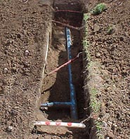
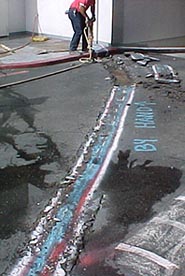
The photo above shows the water line run, which continues on the other side of the courtyard wall. Often utility lines will take a direct path between two points. Or, as in this case, the run will meander to avoid other underground objects or structures.
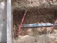
Another reason the water line had to be located was that it had been leaking for quite some time. And due to a cracked slab in the parking garage below water had intruded and weakened post-tensioned cables. The result was a broken cable which erupted from the slab. |
RADAR | XRAY | POST TENSIONED CONCRETE | SPECIALTY PROJECTS | CONSULTING | UTILITY STRIKES | ABOUT | HOME